


|
Lower Manhattan Development Corporation
|
|
    |
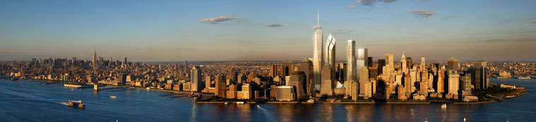 A View of the World Trade Center Site from the Hudson River.
 The attacks on the World Trade Center and the subsequent recovery had a profound impact on Lower Manhattan's communities. Many residents could not return to their homes for weeks or months and when they did return, endured closings of streets and public spaces, transportation disruptions, and re-laying of electrical cables. Throughout it all, Lower Manhattan residents have shown remarkable resolve to remain in their communities. The progress in restoring a normal quality of life over the last two years has been dramatic, but the full recovery of Lower Manhattan will take several years to achieve, and will require the continued patience, commitment and perseverance of downtown's residents and businesses. LMDC is committed to ease the hardships during the recovery period and to ensure Lower Manhattan emerges from this tragedy even better than it was before. In addition to the planning currently underway on the World Trade Center site, an integral part of LMDC's efforts to revitalize Lower Manhattan is a series of studies to identify short-term and long-term solutions to the challenges facing Lower Manhattan's neighborhoods in the wake of September 11, 2001.
The East River Waterfront Esplanade & Piers Project 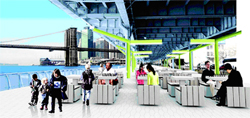 The East River Waterfront Esplanade and Piers Project is a plan to improve a two-mile section of the east side waterfront in Lower Manhattan. The Project involves the design, renovation and expansion of the East River Esplanade from Peter Minuit Plaza in the south to East River Park in the north. The Project includes the creation of new City-owned public open space that enhances connections between neighborhoods, improves the function and appearance of the waterfront, and provides amenities to facilitate access to the waterfront. LMDC conducted a comprehensive environmental review under state and federal law. On November 8, 2007, LMDC�s Board approved the Record of Decision and Lead Agency Findings Statement for the East River Waterfront Esplanade and Piers Project after consideration of all public comments received on the Final Environmental Impact Statement earlier this year. This approval marks the conclusion of the environmental review process. With the environmental review process now complete, LMDC will seek formal release of up to $137 million in federal grant funds to support and implement the Project. In 2008, LMDC and The City of New York will work closely to complete the schematic designs and begin construction of this newly-envisioned stretch of waterfront. LMDC Awards $70 Million Grant for Hudson River Park The $70 million in funding approved by the LMDC Board on September 8, 2005 will be used to build "Segment 3." Segment 3 encompasses Lower Manhattan and Tribeca, and its boundaries extend from Chambers Street to Houston Street. Within this area will be two public recreational piers (Piers 25 and 26), an ecological pier, and the adjacent upland park. Hudson River Park is being constructed by the Trust, the joint City-State public benefit corporation charged with the park's planning, design, construction and operation. Greenwich Street South: The 8-acre Brooklyn Battery Tunnel Plaza, which runs along Greenwich Street, represents the single-largest development opportunity downtown after the World Trade Center site. The Greenwich Street South study looks at ways to unlock the full potential of the Brooklyn Battery Tunnel Plaza by examining ways to incorporate new housing and neighborhood amenities into the area as well as the ability to forge new connections between neighborhoods. The plan envisions the transformation of this under-performing area into a new residential enclave and open space for Lower Manhattan � linking the World Trade Center site with Battery Park.
Public Realm Enhancements: Although Lower Manhattan remains the third largest central business district in North America, it has been in decline for several decades (eclipsed some time ago by Midtown Manhattan - the largest central business district in the nation). The Public Realm Enhancement Study will cover the entire historic core of the Financial District (a triangular site of approximately 104 acres) bounded by Fulton Street on the north; Church Street on the West; Water Street on the east; and the intersection of Whitehall and Water Street on the south. The study will develop in close collaboration with a variety of agencies, including the New York City Departments of City Planning, Parks, and Transportation. In order to find the most effective physical structures for a linked network of open spaces, and one which will take into account the changing nature of the daily and residential populations in Lower Manhattan, this study will re-consider the value and current use of all forms of open public space in Lower Manhattan. The variety of public spaces within the study area is varied: spaces above and below ground; publicly and privately owned spaces; indoor and outdoor spaces; and a diverse set of streets and plazas representing the entire history of public space in the historic core of New York City. Chinatown / Brooklyn Bridge Study:
The Chinatown/Brooklyn Bridge Anchorage Study combines two efforts undertaken by the LMDC. In December of 2004, the LMDC released a report on the Chinatown Access and Circulation Study which was the culmination of a nearly 15-month effort initiated in July 2003 by the Lower Manhattan Development Corporation, in cooperation with the New York City Department of Transportation, to address the transportation and access issues in Chinatown compounded by the events of 9/11 and to identify possible solutions for other transportation problems in this vital area of the city. Recommendations outlined in the report were shaped by community meetings with Chinatown residents as well as the input of various New York City agencies. The report was prepared by Parsons Brinkerhoff Quade & Douglas, Inc. in association with Chan & Krieger & Associates and SIMCO Engineering. Chinatown Access and Circulation Study: |